
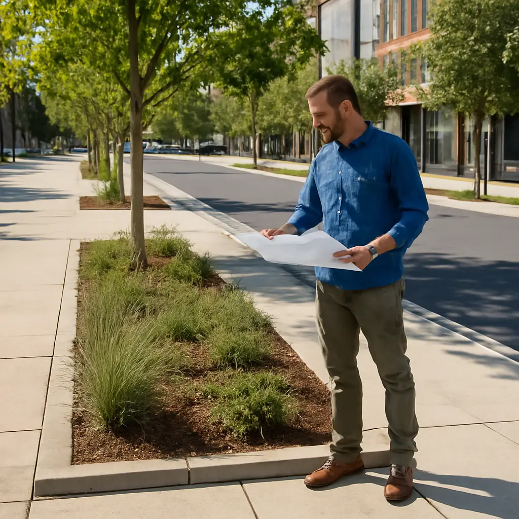
Landscape architects are rethinking sidewalks as more than strips of pavement: they are designing them as public spaces that manage heat and rain, support walking and wheelchair access, and make room for trees, transit, and neighborhood life. The shift responds to urgent pressures: the U.S. Environmental Protection Agency reports that urban areas are often 1–7°F hotter than surrounding areas by day, while the National Association of City Transportation Officials (NACTO) describes sidewalks as essential parts of the public right-of-way, not merely leftover space beside roads. Contemporary projects—from New York’s pedestrian plazas to green stormwater streets in Philadelphia—show how planting, seating, accessible routes, and drainage can be combined. This article examines the principles behind that change, the design elements shaping new sidewalks, and the evidence and trade-offs cities should consider.
Sidewalk design shifts from circulation space to public realm
A sidewalk is the pedestrian portion of a street, but contemporary landscape architecture treats it as a layered public environment. NACTO’s Urban Street Design Guide frames streets as public spaces with multiple functions, including movement, access, social activity, and ecological performance. In practice, that means a sidewalk may include a clear walking path, a furnishing and planting zone, space for building entrances and outdoor activity, and connections to crossings and transit.
The redesign matters because streets shape everyday access to jobs, schools, shops, and public transport. The U.S. Department of Transportation’s National Roadway Safety Strategy identifies pedestrians as vulnerable road users, reinforcing the need to design streets for people outside vehicles. Meanwhile, the Centers for Disease Control and Prevention (CDC) reports that only about one in four U.S. adults meets the federal guidelines for both aerobic and muscle-strengthening activity. Safe, comfortable walking routes cannot solve that public-health challenge alone, but they can make routine physical activity more practical.
The key design move is to coordinate functions rather than squeeze them indiscriminately into a narrow corridor. Landscape architects and engineers assess pedestrian volumes, accessible clear width, shade, drainage, utilities, deliveries, and the needs of adjacent businesses. The resulting sidewalk is less a single surface than a set of connected zones.
The accessible pedestrian route
The accessible route is the continuous, unobstructed path intended for pedestrian travel. Under the U.S. Access Board’s Public Right-of-Way Accessibility Guidelines, accessible pedestrian routes need compliant surfaces, widths, slopes, and transitions; curb ramps and detectable warnings are also important where sidewalks meet streets. These requirements make accessibility a foundational design condition, not an optional amenity.
Designers often keep furniture, signs, tree trunks, café seating, and utility hardware outside the clearest walking line. That distinction helps people using wheelchairs, walkers, or canes, while also reducing conflicts for families with strollers and people carrying luggage. A route that looks generous on a plan can still fail in use if utility covers, leaning poles, or seasonal café furniture obstruct it, so maintenance and operations belong in the design process.
The furnishing and frontage zones
The furnishing zone is the space between the walking path and the curb or street edge; it can accommodate trees, lighting, benches, bicycle parking, signs, and stormwater features. The frontage zone lies next to buildings and may support entrances, windows, queuing, or outdoor dining. NACTO guidance emphasizes organizing these elements so that the pedestrian path remains legible and unobstructed.
These zones are especially useful on busy commercial streets, where a single undifferentiated strip must otherwise serve walkers, deliveries, café customers, and street furniture. Their dimensions depend on street width, pedestrian demand, local codes, and the needs of adjacent uses; there is no universal layout that fits every block.
Climate-responsive sidewalk design manages heat and rain
Climate-responsive sidewalk design uses vegetation, soil, shade, and water-management features to improve outdoor comfort and reduce runoff. The EPA describes the urban heat-island effect as the tendency for built-up areas to be warmer than nearby less-developed areas. Its estimates indicate that urban areas can be about 1–7°F warmer during the day and 2–5°F warmer at night. Those ranges vary with local climate, urban form, and measurement conditions, but they show why shade and surface choices matter.
Rain presents a parallel challenge. Conventional pavement directs water quickly into drainage systems, while planted areas and permeable materials can slow, capture, or infiltrate some runoff when site conditions allow. Landscape architects increasingly treat sidewalks as small pieces of urban green infrastructure—but the benefits depend on adequate soil volume, appropriate planting, functioning drains, and long-term maintenance.
Street trees and shade
Street trees provide shade and can cool nearby areas through evapotranspiration, the process by which water moves through plants and evaporates from leaves. The U.S. Forest Service’s urban-forest research identifies cooling, stormwater interception, and other environmental benefits among the services trees can provide. On sidewalks, the practical design challenge is to give trees enough connected soil and rooting space without compromising the accessible route, utilities, or pavement stability.
A tree canopy can make a walking route more inviting during hot weather, but planting alone is not a quick fix: young trees provide less shade than mature ones, and survival depends on species selection, watering, soil conditions, and care. Designers therefore pair tree planting with a realistic maintenance plan and may use awnings or other shade structures where canopy establishment will take time.
Green stormwater infrastructure
Green stormwater infrastructure uses soils and vegetation to capture or manage rainfall near where it lands. Sidewalk applications include rain gardens, curb extensions with planted areas, tree trenches, and permeable paving. The EPA’s green-infrastructure guidance describes these approaches as ways to help manage stormwater while also supporting community and environmental benefits.
Philadelphia’s Green City, Clean Waters program offers a prominent city-scale example. The Philadelphia Water Department launched the program in 2011 with a 25-year plan to reduce combined sewer overflows through green infrastructure and other measures. Projects such as planted curb extensions and stormwater tree trenches show how streetscape work can serve drainage goals as well as pedestrian needs. Results depend on site-specific engineering: soil infiltration, groundwater, underground utilities, and overflow routes all need evaluation before a planted feature is installed.
Materials and thermal comfort
Pavement materials influence durability, accessibility, drainage, and surface temperature. Permeable paving can allow water to pass through joints or porous material, but it is not appropriate everywhere and may require more frequent cleaning to prevent clogging. Designers also consider glare, slip resistance, repairability, and whether a surface remains smooth and stable for mobility devices.
The most effective material choice is therefore contextual rather than fashionable. A permeable surface that clogs or settles can undermine its intended benefit; a highly reflective surface may create glare; and a heavily textured path may be difficult for some pedestrians to navigate. Material specifications should be tested against local climate, maintenance capacity, accessibility standards, and expected foot traffic.
Sidewalk design supports safety, mobility, and social life
A people-first sidewalk connects movement with the experience of being in public. It can make crossings shorter, improve visibility, create places to pause, and provide a safer-feeling route to transit and local destinations. The design must still balance competing uses: wider walking areas may mean less room for parking or vehicle movement, while adding benches or plantings requires a plan for upkeep and access.
Pedestrian plazas and reclaimed street space
A pedestrian plaza repurposes some street space for walking, gathering, or outdoor activity. New York City’s Plaza Program, led by the Department of Transportation, has worked with community partners to create public plazas in neighborhoods with limited open space. These projects illustrate how street space can be redesigned around local needs, using elements such as seating, planters, and pedestrian-priority layouts.
Plazas are not simply wider sidewalks. They require decisions about traffic access, deliveries, emergency vehicles, accessibility, programming, and who is responsible for maintenance. Community involvement is particularly important: a layout that supports one group’s preferred activity may exclude others if seating, shade, or access is poorly distributed.
Curb extensions and safer crossings
A curb extension, sometimes called a bulb-out, extends the sidewalk into the parking lane near a crossing. It can shorten the distance pedestrians travel across a street, improve sightlines between drivers and walkers, and create additional space for planting or stormwater capture. NACTO’s street-design guidance presents curb extensions as a tool for managing crossing conditions and organizing the street edge.
The feature must be coordinated with vehicle turning paths, drainage, accessible curb ramps, bicycle movements, and loading needs. A curb extension is most useful when it addresses a real crossing or visibility problem; it should not be treated as a decorative add-on detached from the street’s traffic and access pattern.
Seating, rest, and everyday access
Seating lets people rest, wait, meet, and spend time in public space. For older adults, people with disabilities, caregivers, and anyone walking a long distance, places to pause can influence whether a route feels usable. Yet benches need to be positioned so they do not block the accessible route, and their location should account for shade, visibility, and nearby destinations.
Good sidewalk design also recognizes that not every pedestrian moves at the same speed or has the same needs. A comfortable route offers clear wayfinding and predictable surfaces, while a lively street provides enough space for people to stop without forcing others into the curb zone. That balance connects public-space design to practical questions of equity and access.
How cities can evaluate sidewalk redesigns
Sidewalk projects are most successful when cities measure performance after construction, not just compliance before it. Evaluation can compare conditions before and after a redesign and should include both physical performance and people’s experience. Useful measures include pedestrian counts, crossing behavior, tree survival, shade coverage, stormwater captured, accessible-route obstructions, and public feedback.
- Record pedestrian volumes and crossings at different times of day and seasons.
- Audit accessible routes for clear width, surface condition, curb ramps, and temporary obstructions.
- Track tree health, canopy growth, irrigation needs, and replacement rates.
- Inspect green-infrastructure features after storms and document maintenance or clogging.
- Gather feedback from nearby residents, businesses, transit users, and people with disabilities.
These indicators help reveal trade-offs. For example, a planted feature may capture runoff but narrow the walking zone; a plaza may attract visitors but require more frequent cleaning and programming. Monitoring makes it possible to adjust operations and future designs based on observed results rather than assumptions.
Conclusion: design sidewalks as connected public infrastructure
Today’s landscape architects are rethinking sidewalks as accessible routes, climate infrastructure, safer street edges, and everyday public spaces. Clear pedestrian paths and well-organized furnishing zones support movement; trees and green stormwater systems can provide shade and manage rainfall; and plazas, curb extensions, and seating can strengthen street life when they are planned around local needs.
The broader implication is that sidewalk quality affects how people experience a neighborhood and reach its essential destinations. Cities considering redesigns should pair accessibility and safety standards with climate-aware planting, community engagement, and funded maintenance. For further exploration, review NACTO’s street-design guidance, the U.S. Access Board’s public right-of-way accessibility guidelines, and local green-street programs—and ask municipal planners how residents can participate in upcoming projects.
Sources: National Association of City Transportation Officials, Urban Street Design Guide, https://nacto.org/publication/urban-street-design-guide/; U.S. Environmental Protection Agency, Learn About Heat Islands, https://www.epa.gov/heatislands/learn-about-heat-islands; U.S. Access Board, Public Right-of-Way Accessibility Guidelines, https://www.access-board.gov/prowag/; Centers for Disease Control and Prevention, Physical Activity, https://www.cdc.gov/physical-activity/php/about/index.html; U.S. Department of Transportation, National Roadway Safety Strategy, https://www.transportation.gov/NRSS; U.S. Forest Service, Urban Forests and Human Health, https://www.fs.usda.gov/research/treesearch/; Philadelphia Water Department, Green City, Clean Waters, https://www.phila.gov/programs/growing-greater-philadelphia/green-city-clean-waters/; New York City Department of Transportation, Plaza Program, https://www.nyc.gov/html/dot/html/pedestrians/nyc-plaza-program.shtml; U.S. Environmental Protection Agency, Green Infrastructure, https://www.epa.gov/green-infrastructure