
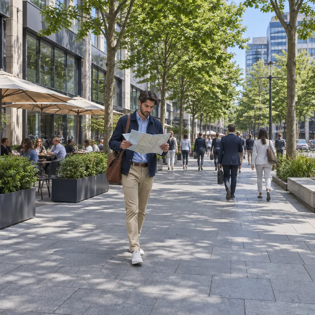
Business-district foot traffic is the number of people who visit and move through a commercial area during a given period. Increasing it means making the district easier to reach, more comfortable to walk, and more rewarding to visit. The most reliable approach combines attractive public spaces, a varied mix of businesses and activities, events, safe and convenient access, and ongoing measurement. These strategies matter to local businesses and communities: the U.S. Environmental Protection Agency notes that walkable neighborhoods can support local economies, while the International Council of Shopping Centers has reported that many consumers value in-person shopping for the ability to see, touch, and try products. Results depend on local conditions, so districts should test changes and track visits, dwell time, and business outcomes.
Improve Walkability and Public Space in a Business District
Walkability is the extent to which people can reach destinations on foot safely, comfortably, and conveniently. The U.S. Environmental Protection Agency describes walkable communities as places with connected streets, nearby destinations, and pedestrian-friendly design. For a business district, this means more than adding sidewalks: it includes safe crossings, accessible routes, shade, seating, lighting, and public spaces that invite people to pause.
Walkability supports foot traffic by reducing friction between destinations. A visitor who can comfortably walk from a transit stop to a café, shop, park, or cultural venue is more likely to explore several blocks rather than make a single stop. Useful measures include pedestrian counts by block and time of day, average dwell time, accessibility audits, and the number of destinations reachable within a short walk.
Create Comfortable, Accessible Streets
Street comfort combines physical safety, universal access, and protection from weather. District managers can prioritize continuous sidewalks, curb ramps, clear paths around street furniture, shorter crossing distances, visible crosswalks, traffic-calming measures, benches, trees, and pedestrian-scale lighting. The U.S. Access Board’s accessibility standards provide technical requirements for accessible routes and pedestrian facilities; local projects should also consult applicable state and municipal codes.
A useful first step is a walk-through audit with people who have different mobility, sensory, and age-related needs. Record obstacles such as uneven pavement, blocked curb ramps, poor lighting, and confusing crossings, then assign each issue an owner and deadline. Where permanent construction is not immediately feasible, temporary treatments—such as planters, painted curb extensions, or movable seating—can help test a design before larger investment.
Use Plazas, Seating, and Greenery to Encourage Dwell Time
Public-space improvements give visitors reasons to stay rather than pass through. Small plazas, pocket parks, shade, drinking fountains, public art, and flexible seating can make a district more inviting for families, workers, and older adults. The Project for Public Spaces’ placemaking approach emphasizes that successful public places are comfortable, sociable, accessible, and useful for a variety of activities.
Start with low-cost, reversible changes and observe how people use them. For example, a district can add movable chairs, planters, or a weekend seating area, then compare pedestrian counts and dwell time before and after installation. A simple chart can show hourly footfall alongside temperature, weather, and event schedules, helping distinguish the effect of the design change from seasonal variation.
Diversify Businesses and Activities in a Business District
A business mix is the range of shops, services, food venues, cultural institutions, and other destinations available in an area. A varied mix can attract different visitors at different times, creating reasons to return beyond a single shopping trip. The International Council of Shopping Centers’ consumer research has highlighted the continued value of in-person retail experiences, including the opportunity to interact with products and receive service. That advantage is strongest when retail is part of a broader district experience.
District leaders can map storefront vacancies, business categories, operating hours, and customer needs to identify gaps. The goal is not to make every block identical; it is to build complementary destinations that support both everyday errands and occasional visits.
Support Independent Businesses and Storefront Activation
Storefront activation means making street-facing spaces visibly useful and engaging. Independent shops, cafés, galleries, markets, and service businesses can add local character, while temporary pop-ups can bring activity to vacant units. Business improvement districts and local governments may support these efforts through façade grants, short-term leases, tenant matchmaking, signage guidance, or shared marketing.
Vacancy is not only an economic concern; dark or inactive frontages can make a street feel less inviting. Where a permanent tenant is not yet available, owners can use window displays, community exhibitions, temporary retail, or artist installations. Track occupied storefronts, vacancy duration, opening hours, and pedestrian counts to evaluate whether activation is translating into a more lively street.
Coordinate Retail, Dining, Services, and Culture
A mixed-use district brings together destinations that serve different needs and schedules. Grocery stores, restaurants, personal services, offices, libraries, entertainment venues, and cultural spaces can create activity across the day and week. The U.S. Environmental Protection Agency’s smart-growth guidance connects compact, mixed-use development with access to destinations and reduced dependence on driving.
Coordination matters as much as variety. Businesses can align hours for selected evenings, create cross-promotions, and package visits—for example, a gallery opening followed by a restaurant offer. District organizations should also consider whether essential services and affordable options are represented, so the area serves residents as well as visitors.
Use Events and Programming to Increase Business-District Visits
District programming consists of planned activities that bring people into public spaces, such as markets, performances, seasonal celebrations, outdoor dining, and family activities. Events can generate a short-term attendance lift and introduce visitors to businesses they may not otherwise discover. Their lasting value depends on converting event attendance into repeat visits and regular spending.
A strong program balances signature events with smaller, recurring activities. Before scheduling, identify the audiences to reach, the blocks that need activity, the businesses that can participate, and the practical requirements for permits, sanitation, accessibility, and safety.
Build Recurring Markets and Seasonal Events
Recurring events—such as a weekly farmers market, monthly art walk, or regular outdoor performance—give people a predictable reason to return. Seasonal programming can extend the calendar with lighting, holiday markets, summer performances, or cultural celebrations. Market and event organizers should work with nearby businesses so visitors have clear routes to shops, food, and services.
Measure event performance using attendance estimates, pedestrian counts on adjacent blocks, participating-business sales where voluntarily shared, and visitor surveys. Compare event days with similar non-event days and account for weather and holidays. This helps distinguish a genuinely effective program from a busy day caused by unrelated factors.
Make Events Inclusive and Easy to Attend
Inclusive programming is planned so people with different incomes, ages, abilities, languages, and cultural backgrounds can participate. Practical steps include free or low-cost activities, accessible routes and toilets, seating, clear multilingual information where appropriate, family-friendly timing, and transit or bicycle access details. Consultation with local residents and community groups helps ensure that events reflect the district rather than imposing an outside vision.
Consider distributing activities across several blocks instead of concentrating all foot traffic at one site. This can expose visitors to more storefronts and reduce crowding. A map showing event locations, accessible entrances, transit stops, bicycle parking, and participating businesses can make exploration easier.
Improve Access, Safety, and Wayfinding to a Business District
Access is the ease with which visitors can reach and navigate a district by walking, cycling, public transit, or driving. Effective access planning does not treat parking as the only concern: it considers the entire journey, including transit service, crossings, bicycle facilities, loading, drop-off areas, and clear directions. The National Association of City Transportation Officials’ street-design guidance emphasizes designing streets for the people who use them, including pedestrians, cyclists, transit riders, and motorists.
Perceived safety also influences whether people visit and how long they stay. Clean sidewalks, active frontages, reliable lighting, visible crossings, and a responsive maintenance process can improve comfort. District managers should coordinate with city agencies, property owners, transit providers, and community organizations rather than treating safety as a single department’s responsibility.
Connect Transit, Walking, Cycling, and Parking
Multimodal access means making it practical to reach the district using different transportation modes. Actions may include improving pedestrian routes from transit stops, adding secure bicycle parking, providing clear parking information, managing loading zones, and coordinating event schedules with transit service. The U.S. Department of Transportation’s Complete Streets principles support planning streets for safe access by people of all ages and abilities, regardless of how they travel.
Use local travel data to identify barriers. Short visitor surveys can ask how people arrived, what made the trip difficult, and what would encourage another visit. Pair those responses with transit-stop usage, bicycle counts, parking occupancy, and pedestrian observations to avoid investing in facilities that do not address the district’s actual access problems.
Use Clear Wayfinding and a Consistent District Identity
Wayfinding is the system of signs, maps, landmarks, and digital information that helps people understand where they are and how to reach destinations. Consistent signs can direct visitors from transit stops and parking areas to shops, public facilities, and event locations. A recognizable district identity—used consistently across signs, maps, event listings, and business materials—makes the area easier to find and remember.
Keep directions readable, accessible, and current. Include walking times rather than only distances where useful, and ensure digital maps match on-street conditions. Monitor whether visitors can find key destinations through brief intercept questions or observation, then update confusing signs and outdated listings.
Measure and Sustain Foot Traffic Growth in a Business District
Foot-traffic measurement is the systematic collection of information about pedestrian volume, movement, and visits. Counts alone show how many people passed a point, but not necessarily whether they entered businesses, stayed longer, or returned. A useful evaluation combines pedestrian counts with dwell time, business participation, visitor feedback, vacancy trends, and, where businesses choose to share them, sales indicators.
The International Downtown Association’s research on downtowns and urban places illustrates the value of combining economic, social, and physical indicators when assessing district conditions. Local measurement should likewise connect activity on the street with outcomes that matter to businesses and residents.
Establish a Baseline and Track Comparable Periods
A baseline is a recorded snapshot of conditions before an intervention. Count pedestrians at consistent locations and times, and document weather, construction, holidays, school schedules, and major events. Automated counters, manual observations, privacy-conscious mobility data, and voluntary business surveys each have strengths and limitations; explain methods clearly and protect personal information.
Compare like with like—for example, the same weekday and time in similar seasons—rather than comparing a rainy Tuesday with a festival Saturday. A practical dashboard can report pedestrian volume, average dwell time, event attendance, storefront vacancy, transit access, and survey results. Where possible, use a nearby comparison block to help separate district-wide trends from the effects of a specific project.
Turn Findings into an Ongoing Improvement Plan
An improvement plan turns evidence into assigned actions, budgets, and timelines. Review results with businesses, residents, property owners, transportation agencies, and community groups on a regular schedule. Continue interventions that show benefits, revise those that do not, and publish progress in an accessible format.
Foot-traffic growth should not be treated as the only measure of success. A thriving district also needs businesses that can remain open, public spaces that serve local people, accessible routes, and a sense of belonging. Tracking these outcomes together helps prevent improvements from benefiting only a narrow group or creating problems elsewhere.
Conclusion: Build a More Inviting Business District
Increasing foot traffic requires a connected strategy: make streets walkable and comfortable, create public spaces where people want to linger, support a diverse mix of businesses, program recurring activities, improve access and wayfinding, and measure results consistently. The strongest efforts begin with local needs, test practical changes, and involve the people who use and operate the district.
Start by establishing a pedestrian-count baseline and identifying one or two high-impact barriers, such as an unsafe crossing, inactive storefront, or lack of seating. Then coordinate with local businesses and community partners, try a manageable intervention, and review the results. For further action, consult municipal transportation and accessibility guidance, local business organizations, and the research resources listed below.
Sources: U.S. Environmental Protection Agency, Smart Growth and Transportation, https://www.epa.gov/smartgrowth/smart-growth-and-transportation; International Council of Shopping Centers, The Halo Effect: How Brick-and-Mortar Stores Drive Sales Online, https://www.icsc.com/news-and-views/research/the-halo-effect; U.S. Access Board, Public Right-of-Way Accessibility Guidelines, https://www.access-board.gov/prowag/; Project for Public Spaces, What Makes a Successful Place?, https://www.pps.org/article/grplacefeat; U.S. Environmental Protection Agency, About Smart Growth, https://www.epa.gov/smartgrowth/about-smart-growth; National Association of City Transportation Officials, Urban Street Design Guide, https://nacto.org/publication/urban-street-design-guide/; U.S. Department of Transportation, Complete Streets, https://www.transportation.gov/mission/health/complete-streets; International Downtown Association, Research and Reports, https://downtown.org/research/